TheViewShed
The global index of Earth's ultra-long-distance sight-lines
A geographic data platform cataloguing 1,779+ verified ultra-long-distance views — peaks visible from hundreds of kilometres away — with confirmation status, imagery, and deep filtering across distance, region, and confidence level.
The impact we delivered
Measurable outcomes that transformed TheViewShed's business.
Understanding the problem
There's a small but devoted community of geographers, photographers, and mountain spotters who chase ultra-long-distance views — peaks visible across hundreds of kilometres. Their evidence lives across forums, blogs, and personal spreadsheets. There was no canonical, filterable database. TheViewShed needed to consolidate that scattered knowledge into a fast, searchable global index — and treat each entry like a peer-reviewed scientific record, not a forum post.
How we solved it
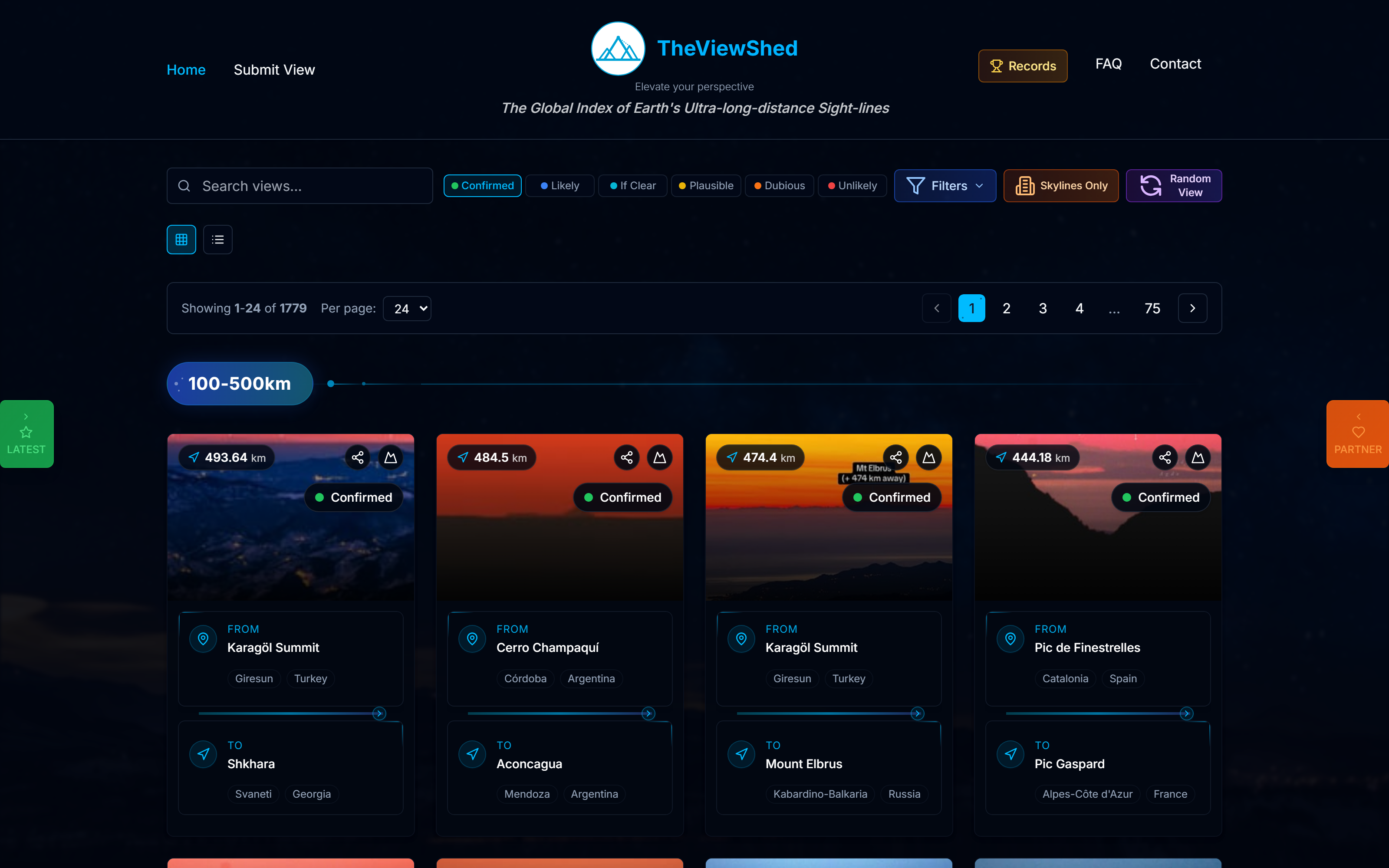
We built a database-first web application around 1,779 ultra-long-distance view records, each tagged with distance, region, observer location, target peak, status (confirmed / likely / clear / possible / dubious / unlikely), and submitted imagery. Filtering, sorting, pagination, and per-view detail pages turn what was a tangle of half-documented claims into a clean, browsable scientific resource — with structured submission for the community to contribute their own.
Step by step
How we approached this project to deliver exceptional results.
Modelled the schema around the actual evidence — observer point, target peak, distance, confidence level, photographic proof — rather than a generic CMS
Built filterable list views with combined filters across confidence (Confirmed / Likely / Clear / Possible / Dubious / Unlikely) and distance bands (100–500km, 500km+, etc.)
Designed each view-card around the photograph and the distance metric — those are the two things observers care about
Implemented submission workflows so the community can contribute new sight-lines with the imagery and metadata required for verification
Added skybox and random-view discovery modes to surface lesser-known entries from the long tail of the index
Project highlights
Key screens and features from the final product.

Filterable index of 1,779 confirmed ultra-long-distance sight-lines

Mobile experience built around the photo and the distance metric
Ready to start your project?
Let's create something amazing together. Tell us about your project and we'll make it happen.